Location: North Island of New Zealand near Gisborne
The Motu River flows through the Raukumara Range, southeast of the Bay of Plenty on the North Island of New Zealand. Rafting trips on the Motu River typically leave from either Gisborne or Opotiki.
Go Rafting with A Commercial Outfitter
Rafting.com is currently seeking qualified outfitters for Featured Listings in this region. If you are a local rafting outfitter and would like to see your company listed here, please contact us for more information.
Level of Difficulty: Class III-V / Beginner – Intermediate
The Motu River can range from Class III to Class V, depending on water level. During most stages, the river is Class IV. Whitewater rafting trips on the Motu range from three to five days in length, so they are perfect for those who want to find an adventurous overnight journey on New Zealand’s North Island. Beginners are welcomed by most outfitters, but should be physically fit and ready for some excitement.
The Canyon: Free Flowing River in a Deep Gorge
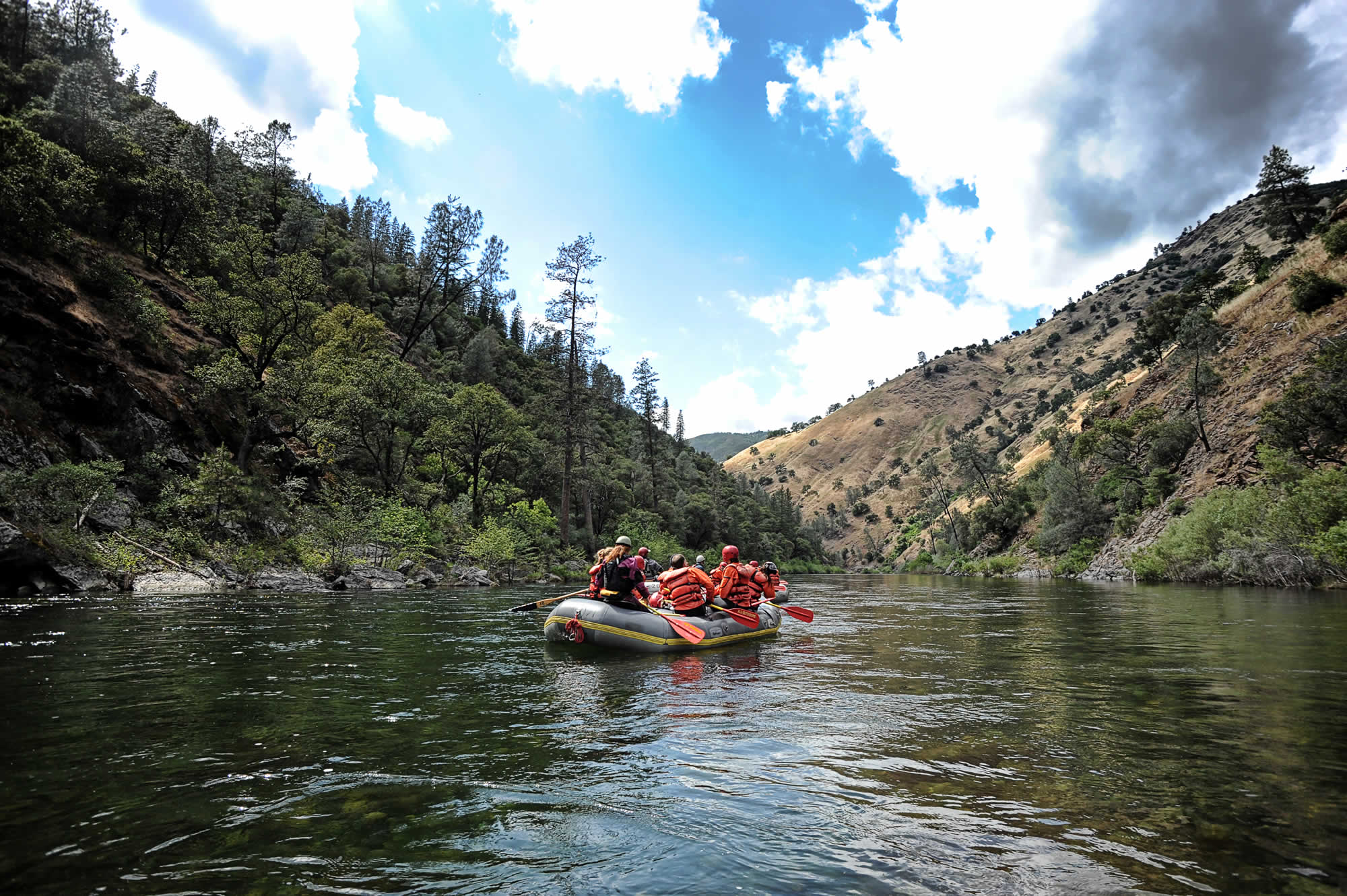
The Motu River is the North Island of New Zealand’s last dam free river, and flows from its source high in the Raukumara mountains 100 kilometers down to the Bay of Plenty. The rugged region through which the Motu River runs was the last area of New Zealand to be mapped, and much of it still remains a mystery. Rafting the Motu is thus a true wilderness adventure, taking boaters through deep gorges of sandstones, mudstones, and breccias lined with the majestic trees of virgin native forest. Along the way, the Motu’s exciting whitewater churns itself into fun Class III and IV rapids with names like “Bullivant’s Cascade”, “The Motu Slot” and “Double Staircase.”
Season: Year-round
The Motu River can be run year-round, but interested adventurers should be in contact with outfitters regarding flows before deciding on a specific date.
| Published December 2008 |
Location: North Island of New Zealand near Taupo and Napier
The Mohaka River drains the north face of the Kaweka Range mountains, eventually flowing into Hawkes Bay, on the North Island of New Zealand. Rafting trips on the Mohaka are generally run out of Taupo, and sometimes out of Napier.
Go Rafting with A Commercial Outfitter
Rafting.com is currently seeking qualified outfitters for Featured Listings in this region. If you are a local rafting outfitter and would like to see your company listed here, please contact us for more information.
Level of Difficulty: Class III, IV-V / Beginner & Intermediate
Rafting trips on the Mohaka River can actually cover a whole range of difficulty, as the river is broken up into several sections. The Te Hoe section offers an easier day of Class III rapids, whereas the lower Mohaka gorges provide Class IV-V whitewater and trips lasting one to four days.
Scenery: Dense Green Forest and Limestone Cliffs
During almost the entirety of its journey from source to sea, the Mohaka River flows through densely forested, precipitous country. In its higher Class IV and V reaches, the Mohaka cuts a series of deep gorges through mudstones and limestone, creating spectacular cliffs sometimes as tall as 150 meters above water level. The whitewater in these gorges is defined by high volume class IV and V rapids with large drops that are broken up by house-sized boulders in the center of the river channel. The river’s name reflects its bouncing course, as Mohaka is a Maori word that translates to mean “a place for dancing.” On overnight trips through the Mohaka’s upper wilderness, there are also great opportunities for fishing and hunting. During the Class III Te Hoe section, the river runs amongst the green rolling hills of the Hawkes Bay area, and the rapids have big fun rollercoaster-like waves with little worries about consequences.
Season: Year-Round
Rafting trips on the Mohaka River are conducted year-round.
| Published December 2008 |
Location: North Island, New Zealand near Rotorua
The Kaituna River is located a short fifteen minutes from Rotorua. The Kaituna flows from Lakes Rotorua and Rotoiti into the Bay of Plenty near Te Puke on the North Island of New Zealand.
Go Rafting with A Commercial Outfitter
Rafting.com is currently seeking qualified outfitters for Featured Listings in this region. If you are a local rafting outfitter and would like to see your company listed here, please contact us for more information.
Level of Difficulty: Class IV-V / Intermediate
The Kaituna is rated Class V, but this rating is given mostly because of two large waterfalls that boats can run. The Kaituna River is most famous for a rapid called Tutea Falls, a seven meter drop that is the highest commercially-rafted waterfall in the world. There are several other steep drops on the run, and seven fun Class III rapids in between. The river is actually mostly Class III-IV, and there are long pools after each steep drop, making it a relatively mellow river compared to others with a Class V rating. Beginners with a good sense of adventure are welcomed by most companies.
The Canyon and History: Deep Gorges with Native Maori Caves
The Kaituna flows through a lush, bush and fern-lined gorge that is of high cultural importance to the native Maori peoples. Behind Tutea Falls people can find caves that were once used to hide women and children during tribal wars, and later as the burial ground for Chief Tutea. The river’s deep gorges are home to unique vegetation that grows only in such deep and moist environments. The intimate nature of this gorge has the ability to make one feel as if they are worlds away from civilization.
Season: Year-round
Whitewater rafting trips are available on the Kaituna River 364 days a year, with the exception being Christmas Day.
| Published December 2008 |
Location: Syracuse, New York
The Black River Gorge offers 7 miles of whitewater rafting. This section of the river begins in Watertown and ends in Brownville. The Black River ends in Lake Ontario in Jefferson County, New York.
Go Rafting with A Commercial Outfitter in New York
Rafting.com is currently seeking qualified outfitters for Featured Listings. If you are a local rafting outfitter in New York and would like to see your company listed here, please contact us for more information.
Level of Difficulty: Class III-V / Beginner – Advanced, depending on the season
The Black River is a versatile whitewater river for New York Rafters of varying abilities. In the spring, Black River rafting offers more adventurous rafters Class IV-V thrilling whitewater. The difficulty level varies in the spring according to the amount of water being squeezed into the Black River Gorge’s narrow and deep walls. The canyon is an impressive 100 feet deep in places, making for unusual scenery and excellent rafting.
In the summer, after the water level drops, the Black River’s rapids become accessible and reliable exciting Class III, making it the perfect outing for families and mixed groups. The slower water also leaves more time for sunbathing, water fights, and relaxation during river trips. Another great feature of the Black River is its outstanding fishing—salmon, pike, and trout.
Season: May – September
Rafting trips on the Black River are offered in the spring and summer with flows and difficulty levels varying greatly depending on the season.
| Published December 2008 |
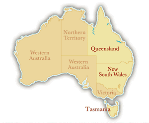
Location: 80 km South of Hobart
The Picton River is located about 80 kilometers to the South of Hobart in Tasmania, off the east coast of Australia.
Go Rafting with A Commercial Outfitter
Rafting.com is currently seeking qualified outfitters for Featured Listings in this region. If you are a local rafting outfitter and would like to see your company listed here, please contact us for more information.
Level of Difficulty: Class II-III / Beginner
The Picton is a Class II-III river, with gentle to moderate rapids that are exciting but not too difficult. This is a great run for beginners and families who want a quick adventure through Tasmania’s bush country and the edge of Australia’s World Heritage-listed rainforest. This river’s level and rapids fluctuate greatly with recent rains: The higher the water level, the more intense and exciting the whitewater. Even at higher levels, however, the river remains a Class III beginner run.
The Canyon: A Mini Rainforest Gorge Lined with Huon Pines, Leatherwood and Myrtles
A day on the Picton takes rafters through a majestic mixture of rainforest greenery and Tasmanian bush; a mixture of Huon Pines, Celery Top Pines, Leatherwood, and Myrtles interspersed with towering Eucalyptus Trees. Mid-way through the trip, boats enter a narrow mini-gorge where rafters encounter one of the more exciting rapids of the day: a wave train culminating in a large hole that keeps getting bigger and bigger the higher the water level. The trip covers 7 kilometers of the Picton’s river canyon, giving people one and a half hours of excitement and beautiful scenery before ending the day with afternoon tea or a late lunch.
Season: Year-Round
Whitewater rafting trips are available on the Picton River all year long.
| Published November 2008 |
Location: 85 km South of Devonport, 40 km West of Mole Creek
The Mersey River originates in the lake district near Mount Pelion East on the Central Plateau in Northern Tasmania, Australia. Fed by the Dasher and Fisher Rivers, the Mersey River is located 85 kilometers South of Devonport and 40 kilometers West of Mole Creek.
Go Rafting with A Commercial Outfitter
Rafting.com is currently seeking qualified outfitters for Featured Listings in this region. If you are a local rafting outfitter and would like to see your company listed here, please contact us for more information.
Level of Difficulty: Class III Beginner
The Mersey River is a Class II-III river, suitable for families and/or those who want a more mellow one-day adventure.
The Canyon: Deep, Willow-Lined Canyon
The Mersey River cuts an impressive canyon, of depths up to 2000 feet, before emptying out into the Bass Straight south of Devonport. In its lower valley, the Mersey flows along rolling hills and willow-lined banks past dairy, fruit and potato farms. Calm stretches are interspersed with fun rapids such as “The First Drop”, “Berlin Wall”, and “The Washing Machine”.
Season: November through March
The Mersey River is best caught in Tasmania’s summer months: November – March
| Published November 2008 |
Location: Near Hobart in Tasmania, Australia
The Franklin River is located in Franklin-Gordon Wild Rivers National Park in Northern Tasmania, Australia. One of this century’s greatest conservation victories, the now-protected Franklin River tumbles 125 un-dammed kilometers from its source on the western edge of the Central Highlands, through the northern area of the Tasmanian Wilderness World Heritage Area, past Frenchman’s Cap, and finally into the Gordon River. The meeting point for rafting trips on the Franklin River is usually somewhere in Tasmania’s capital city of Hobart. The trip itself commences on the Collingwood River, 49 kilometers west of the Derwent Bridge. Trips last anywhere from 5 to 14 days.
Go Rafting with A Commercial Outfitter
Rafting.com is currently seeking qualified outfitters for Featured Listings in this region. If you are a local rafting outfitter and would like to see your company listed here, please contact us for more information.
Level of Difficulty: Class IV+ Beginner – Intermediate
The river ranges from Class I to Class VI, but most of its rapids lie in the Class III-IV range. There are several arduous portages around Class VI rapids, and some trips include a hike up Frenchman’s Cap. The trip’s length, its technical rapids, and its difficult portages all require a fairly good amount of physical ability and a keen sense of adventure!
The Canyon: Rugged Forest, Frenchman’s Cap, and Limestone Cliffs
The Franklin River flows through some of Australia’s most rugged and densely forested terrain, past places of incredible beauty and sites of ancient historical significance. From source to its confluence with the Gordon River, the Franklin drops an impressive 1400 meters. Early in its journey, the river winds around the white quartzite dome of Frenchman’s Cap and through peaceful old-growth rainforest. During the middle reaches, the Franklin’s currents converge into the Great Ravine, one of Tasmania’s deepest and narrowest gorges. Towards the end of its journey, the river escapes the gorges’ narrow confines and emerges into limestone country, replete with dramatic cliffs, strange rock formations, and mysterious caves that once housed Aboriginal peoples as many as 14,000 years ago.
Season: November through April
Your best bet for stable weather and good conditions for rafting on the Franklin River is from December through March. Trips are available, however, from November through April.
| Published November 2008 |
From strikingly sharp mountain ridges, to dense temperate rainforest, and rolling foothills of Tasmanian bush country, Tasmania has no shortage of awe-inspiring backdrops for a whitewater rafting adventure. Rivers range from Class II to Class V, and trips vary in length from one day to fourteen days.
Mersey River (Class II-III):
The Mersey River cuts an impressive canyon just 85 kilometers south of Devonport, and provides a great one-day adventure for families and beginners.
Picton River (Class III):
Located 80 kilometers south of Hobart, a rafting trip on the Picton River is a gentle ride through a mixture of lush rainforest and Tasmanian bush country.
Franklin River (Class IV+):
The Franklin River runs 125 kilometers through Franklin Gordon Wild Rivers National Park, and is a true expedition-style journey in the heart of Tasmania. Trips can last anywhere from five to fourteen days.
Go Rafting with A Commercial Outfitter
Rafting.com is currently seeking qualified outfitters for Featured Listings in this region. If you are a local rafting outfitter and would like to see your company listed here, please contact us for more information.
More About Rafting in Tasmania
An island 200 kilometers south of the Eastern side of Australia, Tasmania remains one of the world’s most pristine and untouched regions. Reserves, National Parks, and World Heritage Sites claim over 37% of the island, and it is famous for having the world’s purest air. Its rivers, therefore, bare witness to some of the world’s oldest forests and varied terrain.
| Published November 2008 |
Location: Northern Queensland, Australia
The Tully River is located about 140 kilometers south and a 2 hours drive from Cairns in Northern Queensland, Australia. It runs between Mount Mackay and Mount Tyson, in the center of one of Australia’s major cane growing regions and World Heritage rainforest.
Go Rafting with A Commercial Outfitter
Rafting.com is currently seeking qualified outfitters for Featured Listings in this region. If you are a local rafting outfitter and would like to see your company listed here, please contact us for more information.
Level of Difficulty: Class IV / Intermediate – Advanced
The Tully River is a Class IV river, with over 45 rapids that come in quick succession and demand a sense of adventure from its visitors. No prior experience is necessary, but paddlers should be ready for a more active and exhilarating day of rafting.
The Canyon: Ancient Rainforests
No exception to Australia’s far northern rivers, the Tully also cuts a path through World Heritage-listed ancient rainforest. It flows through steep-walled gorges of basaltic rock past some of the oldest trees still alive on the planet. Lucky visitors will catch sightings of water dragons and exotic birdlife. Abundant waterfalls cascade over the canyon walls, and lunch is enjoyed across the river from one called “Ponytail Falls”. Five hours of rafting adventure include rapids such as “Alarm Clock”, “Staircase Rapid” (aptly-named), “Corkscrew”, and “Double Waterfall”.
Season: All Year
Because of Australia’s moderate climate and the fact that the Tully River has several dams, rafting trips are available all year long!
Video: Commercial Whitewater Rafting Trip on the Tully River
For a better visual of the canyon and two of the river’s rapids, take a look at this video from someone who did a commercial rafting trip on the Tully a few years ago.
| Published November 2008 |
Choose from four of Queensland’s most popular whitewater rafting trips:
Baron River Rafting Trips (Class III):
The Baron River runs through the World-Heritage listed Wet Tropics of the Atherton Tableland, just 20 minutes drive from Cairns.
Russell River Rafting Trips (Class IV):
The Russel provides continuous, exciting whitewater as it winds through a narrow, steep gorge an hour’s drive outside of Cairns.
Tully River Rafting Trips (Class IV):
2 hours south of Cairns, the Tully River has 45 rapids that cut a steep course through some of the World’s most ancient rainforest.
Johnstone River Overnight Rafting Trips (Class V):
Rafting trips on the Johnstone are in such a remote rainforest wilderness, that the journey begins with a helicopter ride into the heart of the region. These rapids are some of the more challenging Australia has to offer.
Go Rafting with A Commercial Outfitter
Rafting.com is currently seeking qualified outfitters for Featured Listings in this region. If you are a local rafting outfitter and would like to see your company listed here, please contact us for more information.
More About Rafting in North Queensland
Tropical North Queensland is most famous for its off-shore reefs, but it is also home to one of the world’s most well-preserved, ancient rainforest. Rafting in North Queensland gives people the opportunity to explore the heart of Australia’s pristine rainforest in a much more intimate manner than is otherwise possible. Highlights include numerous waterfalls, exotic wildlife, sacred Aboriginal cultural sights, basalt formations, and incredibly lush flora. Rivers range from Class III to Class V, and trips range from 1 to 6 days in length. There are whitewater choices for everyone, from families looking for a day of fun, to adventurers seeking an expedition-style journey.
| Published November 2008 |